LOCATION:
DEPTH:
MAGNITUDE:
39.4560N 39.7738E (KOERI)
39.46N 39.79E
(USGS)
10.0 kilometers
6.5 (KOERI) - 6.1 (USGS), Mw=6.0
JAN 27, 2003 PÜLÜMÜR-TUNCELİ (TURKEY) EARTHQUAKEPreliminary Report (Updated Jan 29, 2003) |
| DATE
-TIME:
LOCATION: DEPTH: MAGNITUDE: |
2003
01 27 05:26:22 UTC
39.4560N 39.7738E (KOERI) 10.0 kilometers 6.5 (KOERI) - 6.1 (USGS), Mw=6.0 |
|
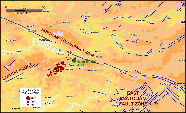
EARTHQUAKE ACTIVITY ( JAN 27-29, 2003) |
||
|
|
||
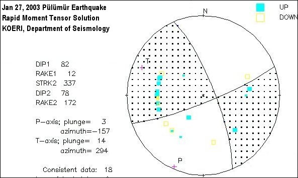
EARTHQUAKE
MECHANISM
|
|
|
|
|
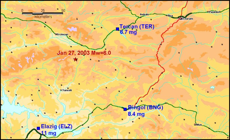
STRONG GROUND
MOTION
|
|
|
The earthquake was recorded by three strong motion recording stations operated by the Earthquake Research Department of General Directorate of Disaster Affairs.The horizontal peak ground accelerations are presented in the following figure. The acceleraiton records can be reached at http://angora.deprem.gov.tr/sond.htm
|
|
|
|
|
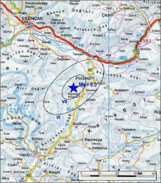
MAP OF SYNTHETIC ISOSEISMALS |
DAMAGE |
|
|
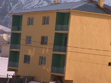
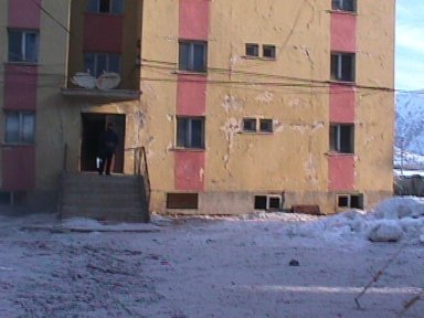
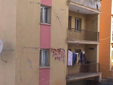
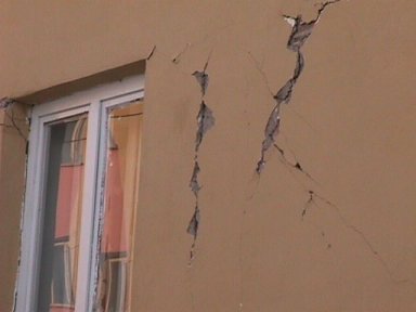
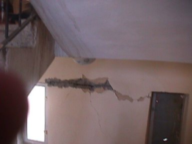
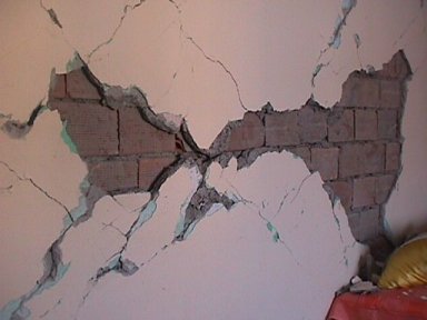
Center of Pulumur; buildings of Pulumur Security Department and Pulumur Municipality, the primary boarding school building, a bank bulding, disaster mass houses and many residential buildings were heavily damaged. 6 people injured. Saglamtas Village; 1 dead,3 residential buildings collapsed,17 residential buildings were heavily damaged Cakirkaya Village; 4 residential buildings collapsed Center of Erzincan; the building of Justice Department was damaged |
PICTURES FROM
PÜLÜMÜR
|
 |
 |
 |
 |
 |
 |
|
|